
The Historical Geography of Madinah: A Guide to Mountains, Valleys, and Prophetic Landmarks
Table of Contents
The Historical Geography of Madinah: A Guide to Mountains, Valleys, and Prophetic Landmarks
The city of Madinah is a tapestry woven with threads of deep faith and profound history. Its significance is not only spiritual but also geographical. The very mountains, valleys, and pathways of Madinah are silent narrators of the Prophet’s era and the early Islamic period. This article provides a detailed exploration of the city’s historical topography, pinpointing exact locations and their proximity to modern landmarks, to bring this sacred history to life.
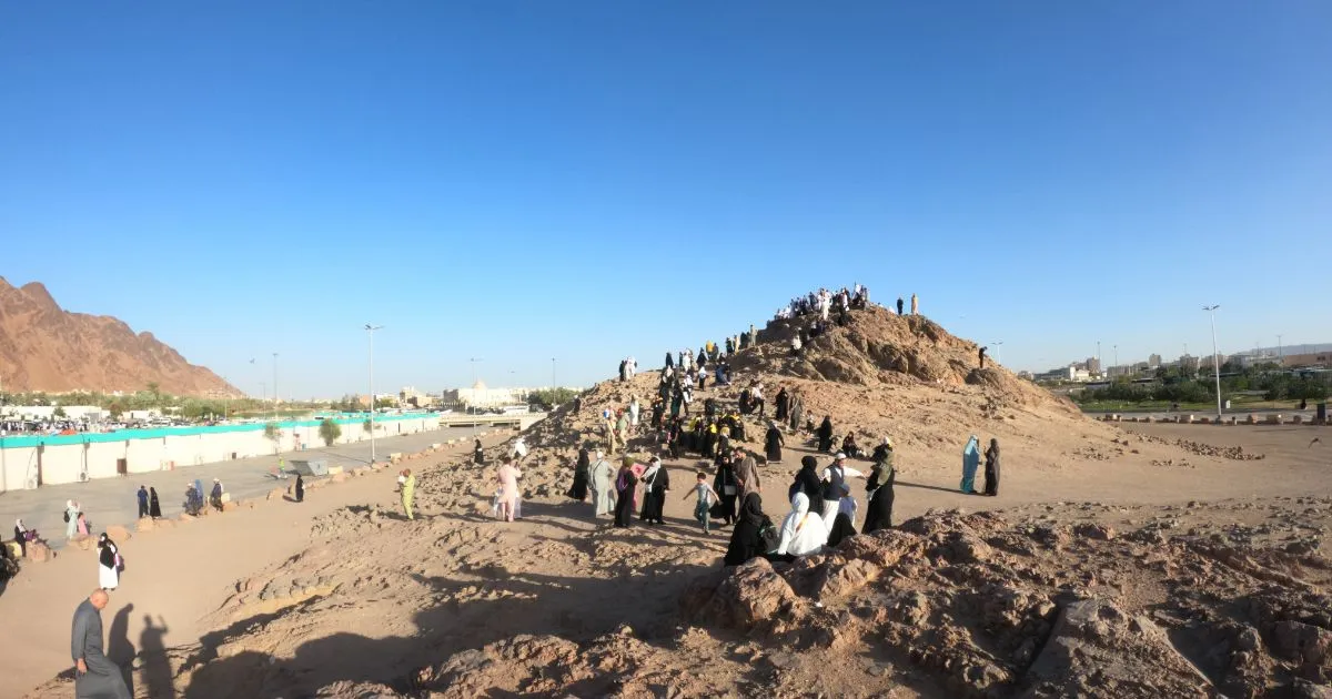
The Twin Hills: Al-Jareen al-Foqani and Al-Jareen at-Tahtani
One of the key topographical features discussed is the pair of hills known as Al-Jareen al-Foqani (the Upper Jareen) and Al-Jareen at-Tahtani (the Lower Jareen).
- Al-Jareen al-Foqani: This is a smaller hill where the mosque of Thaniyat al-Wada’ was originally located. It was first established as a mosque by Caliph Umar ibn Abdulaziz. Despite being called “Upper,” it is the smaller of the two hills. Its designation as “Upper” is due to its position relative to the direction of travel from the Prophet’s Mosque; when leaving Madinah, it comes first on the higher ground.
- Al-Jareen at-Tahtani (Jabal al-Rayyah): This is the larger and more prominent hill, with an estimated height of 20 meters. It is also known as Jabal al-Rayyah or Jabal Dhubab, upon which the Masjid al-Rayyah (Mosque of the Banner) is situated. It was also built by Umar ibn Abdulaziz. Although called “Lower,” it is physically taller; its name comes from its position on the lower part of the route when departing the city.
Exact Location & Proximity: This area is located along the modern Sultanah Road, which follows the ancient path of the Thaniyat al-Wada’ passes. The hills are situated in the northern part of this road network.
Thaniyat al-Wada’ (The Farewell Pass) and its Environs
The Thaniyat al-Wada’ (the Farewell Pass) is a historically crucial mountain pass on the northern exit from Madinah. The area surrounding it was known for its topography and was historically referred to as Ma’atin al-Ibil (the kneeling places of the camels) and Thaniyat ‘Ath’ath.
Exact Location & Proximity: the area between the mountains of Sila’ and Sullay (a smaller mountain) as the location of Thaniyat ‘Ath’ath. This entire region is part of the northern barrier of mountains that naturally fortified Madinah. The Prophet Muhammad (peace be upon him) himself highlighted the city’s natural defenses, once stating in a vision that he saw himself in a strong suit of armor, symbolizing Madinah’s impregnability.
Mountains of Protection: Sila’ and Sullay
The mountains Sila’ and Sullay played a vital role in the geography of Madinah.
- Significance: They were part of the ring of mountains that served as a natural fortification for the city, a divine choice that supported the security of the Prophetic mission.
Exact Location & Proximity: These mountains are located in the area near the modern al-Madad district. Jabal Sila’ is a notable landmark, while Sullay is a smaller mount, now often obscured by modern buildings and neighborhoods.
The Area of al-Midad and the Miracle of the Dates
The area known as al-Midad is significant for a beautiful Prophetic miracle.
- The Miracle: A young girl, the daughter of Abdullah bin Rawahah, was leaving Madinah carrying some dates. The Prophet (peace be upon him) saw her, called her over, and asked what she was carrying. Upon her reply, he gathered people from the area, spread out a cloth, and poured the dates onto it. Through a miracle, the dates multiplied abundantly until everyone had eaten their fill.
- Connection to Poetry: Abdullah bin Rawahah, a poet-companion of the Prophet, later referenced the mountain Sila’ in his poetry, saying: “May Allah water Sila’ and its surroundings, and ask me, you will find me an expert about Sila’.“
Exact Location & Proximity: The area of al-Midad is described as a raised area one would pass when exiting from the “Seven Mosques” area towards the “Two Qiblas” mosque (Masjid Qiblatain). It is in the general vicinity of Sila’. Today, this general region is known as Ard al-Kurdi (the Kurdish Land) and Ard Jamal al-Layl, named after historical farms and families.
Jabal Bani ‘Ubayd and the Seven Mosques Area
Jabal Bani ‘Ubayd is a mountain closely linked to the events of the Battle of the Trench (Ghazwat al-Khandaq).
- Historical Context: The tribe of Bani ‘Ubayd was a branch of Bani Salamah, the people of Masjid Qiblatain (Mosque of the Two Qiblas). The area is also associated with Bani Haram, where another miracle of food multiplication occurred.
Exact Location & Proximity: This mountain is easily identifiable today. It is located on Salaam Road, near the Al-Nabulsi Restaurant. It serves as a key landmark when entering the area of the Seven Mosques (Al-Masajid As-Sab’ah). The site of the miracle for Bani Haram is in this same area, also known as As-Sayih in old photographs, showing how dramatically the landscape has changed.
Defining the Sacred Sanctuary: The Significance of Jabal Thawr
The Prophet Muhammad (peace be upon him) defined the sacred sanctuary (Haram) of Madinah with clear boundaries, mentioning Jabal Thawr as one of its limits.
- The Hadith: He said, “Madinah is a sanctuary from that place to that place… to Thawr… Whoever introduces an innovation in it or grants protection to an innovator, upon him is the curse of Allah, the angels, and all the people.” This underscores the gravity of respecting the sanctity of the city.
Exact Location & Proximity: There is some scholarly discussion, but the most likely candidate for Jabal Thawr of Madinah is the mountain known today as Jabal al-Khazzan or Jabal al-Qadum, located on the road to the old airport, opposite the Al-Haras (National Guard) Hospital. It is important not to confuse this with the more famous Jabal Thawr in Makkah, which houses the cave where the Prophet and Abu Bakr took refuge.
The Valleys of Madinah: The Arteries of History
The valleys (wadis) of Madinah were its lifelines. The Prophet (peace be upon him) highlighted their virtue, asking his companions, “Who among you would like to go every day to Buthan or Al-‘Aqiq and come back with two large she-camels without committing sin or severing ties of kinship?”
Here is a detailed breakdown of the main valleys and their modern trajectories:
- Wadi Al-‘Aqiq: The most famous valley, originating northwest of Madinah. Its course today runs from west to east, passing behind the Noor Mall, near the Imam Ali School, and through the Ard al-Kurdi area. It is intersected by the new road tunnels and eventually merges with other valleys.
- Wadi Buthan: This valley begins near the modern Maktabat al-Malik Faisal and runs parallel to what is now Qurban Road. It flows through the area of Bir Ghars and meets up with Wadi Ranuna near the Tabbakhah (cookware) Market. Its path is now largely built over, following the route of the old Qurban Boulevard.
- Wadi Ranuna: This valley originates from the direction of Jabal al-‘Air. It flows through the Al-‘Asbahah district and the area of Prince Naif’s project (Muhajireen). It meets Wadi Buthan at the Tabbakhah Market.
- Wadi Qana: This is a major valley that enters Madinah from the north. Its course today runs alongside the old airport road, with the airport to its right. It then flows near Jabal Uhud, continues past the Arriyadh (Aryaf) compound behind the Noor Mall, where it converges with Wadi Buthan.
Confluence: After Wadi Buthan, Wadi Ranuna, and Wadi Al-‘Aqiq merge, the combined watercourse continues eastward under the name Wadi al-Hamdh.
Conclusion: A Living Legacy
The historical geography of Madinah is not a subject of the distant past. By understanding the precise locations of its mountains, valleys, and passes—from Jabal al-Rayyah on Sultanah Road to Jabal Bani ‘Ubayd near the Seven Mosques—we can walk through the city with new eyes. Every modern tunnel, roundabout, and neighborhood often rests upon a landscape steeped in Islamic history. This knowledge transforms a visit to Madinah from a purely spiritual journey into a tangible walk through history, allowing one to truly connect with the environment that nurtured the early Muslim community.
Read Also in our Website About History of Masjid Nabawi