
The Vital Stations: Madinah stations that are part of Darb Zubaydah Hajj Route
Table of Contents
Madinah Stations That Are Part of Darb Zubaydah: The Hidden Support Network
When we think of the Darb Zubaydah—the legendary 1,571-kilometer pilgrimage highway from Kufa to Makkah—our minds might picture a solitary desert trail. But the reality was far more sophisticated: a meticulously planned network of support stations that transformed an impossible journey into an organized pilgrimage. While the holy city of Madinah itself was a spiritual magnet, it was the strategic network of Madinah stations that are part of Darb Zubaydah in the surrounding region that physically sustained travelers on their final approach. Groundbreaking research has now identified exactly 13 of these critical waystations. This article reveals their names, locations, and the indispensable role they played as the vital last link in one of history’s greatest pilgrimage infrastructures.
1. The Strategic Corridor: Why Madinah’s Region Was Indispensable
The Madinah stations that are part of Darb Zubaydah were not randomly placed. They occupied a critical geographic corridor that served multiple essential functions for the Kufi pilgrimage route:
- Hydrological Necessity: The northwestern part of the Madinah region, particularly around Al-‘Ula, offered more reliable water sources than the direct southern desert. The route naturally curved to exploit these aquifers and wells.
- Spiritual Convergence: While Darb Zubaydah pilgrims were Makkah-bound, the proximity to the Prophet’s City (PBUH) made a detour for Ziyarah highly desirable. Stations in this region served as launch points for this spiritual side journey.
- Network Integration: This corridor intersected with other major Hajj routes, like the Levantine path from Damascus. The Madinah stations that are part of Darb Zubaydah became hubs where pilgrims, traders, and cultures from across the Islamic world met and resupplied.
- Final Preparation Zone: This sector represented the last major opportunity for caravans to rest, repair equipment, and take on maximal water before the demanding final push to the holy sites of Makkah.
This made the cluster of Madinah stations that are part of Darb Zubaydah a bustling, multilingual, and strategically vital segment of the journey.
2. The 13 Revealed: Complete List of Madinah Stations on Darb Zubaydah
Through rigorous GIS analysis and historical cross-referencing documented in the King Saud University study, we can now name the specific Madinah stations that are part of Darb Zubaydah. These 13 stations (numbered 57-69 in the research) formed a contiguous chain in the region’s northwestern quadrant.
The Documented Stations in Al-Madinah Region:
| # | Arabic Name | English Transliteration / Meaning | Type | Primary Inferred Function |
|---|---|---|---|---|
| 1 | البِدع / البِدَعة | Al Bida’ / Al Bid’ah (“The Settlement”) | Main | Major Hub & Administration. A primary settlement near Al-‘Ula offering comprehensive services. |
| 2 | بُركَة الفُرسان | Birkat Al Fursan (“The Knights’ Reservoir”) | Main | Critical Water Storage. A large, strategically vital water tank. |
| 3 | قَصرُ الخَليفَة / بُركَة العَتِيق | Qasr Al Khalifah / Birkat Al Ateeq (“Caliph’s Palace / Ancient Reservoir”) | Subsidiary | Official & Hydraulic Complex. Combined administrative oversight and water supply. |
| 4 | البُركَة الرَّابِعة | Al Burkah Al Rabi’ah (“The Fourth Reservoir”) | Subsidiary | Sequential Water Supply. Part of a managed chain of reservoirs. |
| 5 | بُركَة خَالِصة | Birkat Khalisah (“The Pure Reservoir”) | Subsidiary | Clean Water Source. A reliable, protected water storage site. |
| 6 | عَقَبَة الأَجفَر | Aqabat Al Ajfar (“The Ajfar Pass”) | Subsidiary | Mountain Passage & Guidance. A navigational point through rugged terrain. |
| 7 | مَحَطَّة الغِربَان / القَرنِين | Mahattat Al Ghiraban / Al Qarnain (“Crows’ Station / The Two Horns”) | Subsidiary | Landmark Navigation. A station named for distinctive geographic features. |
| 8 | مَحَطَّة الغِربَان / القَرنِين | (Extension of Station 7) | Subsidiary | Continuation or secondary facility of the landmark station. |
| 9 | بُركَة الحَاليَّة / اللُّغَويَّة | Birkat Al Haliyyah / Al Lughawiyyah | Subsidiary | Local Water Point. Serviced a specific well or area. |
| 10 | تُوز / الحَـقُوقَة | Tooz / Al Haquqah (Possibly “Mulberry”) | Subsidiary | Rest & Provisions. A named stop, potentially for shade and minor supplies. |
| 11 | بُركَة أَهْلَة / الجَثَامَة | Birkat Ahlah / Al Jathamah | Subsidiary | Tribal or Area-Specific Well. Likely associated with a local community. |
| 12 | سَمِيرَاء القَدِيمَة | Sameera’ Al Qadimah (“Ancient Sameera”) | Subsidiary | Village Stop. Resupply at a pre-existing settlement. |
| 13 | قَرُوري / قَارُورة / سَنَاف اللَّحْم | Qaruri / Qarurah / Sanaf Al Lahm | Subsidiary | Final Resupply Point. The last station in the Madinah region before entering Makkah. |
Geographic Insight: This list confirms the Darb Zubaydah did not run through modern Madinah city. Instead, the Madinah stations that are part of Darb Zubaydah were strategically placed along a northwestern corridor, skirting the Harrat Khaybar lava fields and linking the resource-rich Al-‘Ula valley to the southern routes. This path optimized water access and manageable travel distances.
3. Functional Analysis: How These Stations Served Pilgrims
Each type of station had a specialized role within the support network:
- Main Stations (Like Al Bida’ & Birkat Al Fursan): Offered full services: secure lodging, large markets, animal pens, administrative offices, and major water storage. They were destinations in themselves.
- Water-Specific Subsidiaries (The “Birkat” Stations): Functioned primarily as reliable water collection and distribution points. Stations like Al Burkah Al Rabi’ah (The Fourth Reservoir) indicate a systematic, engineered water supply line.
- Navigation & Passage Stations (Like Aqabat Al Ajfar): Provided guides, security, and rest at critical geographic bottlenecks like mountain passes.
- Minor Rest Stops (Like Tooz): Offered basic shade, perhaps a small well, and a chance to rest animals before moving to the next major station.
Together, these Madinah stations that are part of Darb Zubaydah created a predictable, life-sustaining rhythm for travel, with stops spaced at calculated intervals (averaging ~58 km, according to the study).
4. Architectural Clues: What These Station Names Tell Us
The names of the Madinah stations that are part of Darb Zubaydah are archaeological clues:
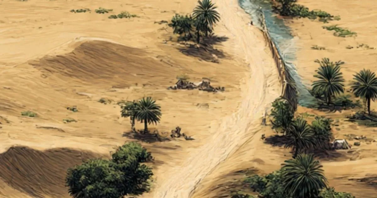
- “Birkat” (بُركَة): Explicitly means reservoir. Confirms the primary infrastructure was hydraulic engineering for water conservation. [IMAGE: A historic birka in the Hijaz region, similar to those on the route].
- “Qasr” (قَصر): Means palace or fort. Qasr Al Khalifah indicates a fortified structure for officials, highlighting state control and security.
- “Aqabat” (عَقَبَة): Means mountain pass. Identifies stations located at geographically challenging points requiring assistance.
- Geographic Descriptors (Al Qarnain – “The Two Horns”): Stations were named after visible landscape features used for navigation.
This naming convention confirms the stations were functional infrastructure, named for their purpose or location, not arbitrary.
5. The Modern Rediscovery: GIS Mapping of the Madinah Sector
The precise identification of these 13 Madinah stations that are part of Darb Zubaydah is the result of modern digital archaeology. The King Saud University study used Geographic Information Systems (GIS) to rescue this heritage from obscurity and threat.
The process for the Madinah sector included:
- Data Fusion: Merging coordinates fromtexts with satellite imagery from USGS and Google Earth.
- Pattern Recognition: Searching for the circular footprints of reservoirs (birkas) and structural ruins along the predicted path.
- Spatial Database Creation: Each potential site, like Birkat Khalisah, was logged with precise coordinates and attributes.
- Historical Verification: Correlating found sites with historical names to confirm their identity, solidifying the list of 13.
This digital record is now the foundational tool for preservation. For broader context on Islamic historical geography, resources like Brill’s Encyclopaedia of Islam offer deep insights [External DoFollow Link: https://referenceworks.brillonline.com/browse/encyclopaedia-of-islam-2].
6. Tracing the Route Today: Where to Find Evidence
While centuries have passed, evidence of these Madinah stations that are part of Darb Zubaydah may still be found by knowledgeable explorers.
- Focus Area: The region northwest of Madinah, towards Al-‘Ula and the Khyber area.
- Physical Evidence to Seek:
- Circular Stone Rings: The remains of reservoir walls are the most identifiable feature.
- Stone Foundations: Low walls or mounds indicating buildings or enclosures.
- Cairns or Stone Markers: Possible waymarkers along the path.
- Critical Advice: These sites are fragile and often on protected or private land. Exploration must be guided and permitted. Start your research at the Madinah Regional Museum or consult with archaeologists at the Kingdoms Institute in Al-‘Ula.
7. Preservation Priority: Protecting Madinah’s Darb Zubaydah Legacy
The story of the Madinah stations that are part of Darb Zubaydah is a testament to Islamic civilization’s logistical brilliance. Their preservation requires a concerted, modern effort:
- Physical Stabilization: Protecting the remaining stonework of reservoirs and structures from further erosion and vandalism.
- Digital Archiving: Using the GIS data to create detailed 3D models and virtual tours of key stations like Al Bida’ or Birkat Al Fursan.
- Interpretive Heritage: Developing educational signage and responsible tourism narratives that explain the function of each station, transforming scattered ruins into a coherent historical journey.
These 13 stations are silent witnesses to a millennia of faith in motion. By mapping, protecting, and explaining them, we do more than preserve archaeology—we honor the enduring human spirit of pilgrimage that they supported and ensure the Madinah stations that are part of Darb Zubaydah continue to tell their story for generations to come.
Read more about Madinah in a blog Section